![]()

|
|
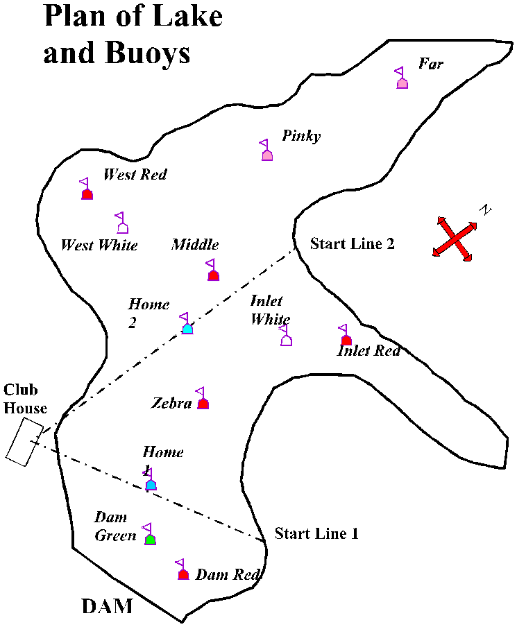
UPPER TAMAR LAKE SAILING CLUB
Plan of Lake and Buoys
The buoys used for racing are not always easy to distinguish from other mooring buoys in the lake, but the map below shows the relative positions.
(Note: this plan has now been updated as of April 2008. At the bottom of this page, there is also a Google Maps link which gives another view of this link; it does have the advantage that it can display the lake as an aerial view))
Link to Google Maps plan of Tamar Lake Buoys
(Note that you can switch between a map view or an aerial view, by clicking the tabs at top right of map; clicking on a buoy identifies the name)
(Click on 'View Larger Map' to see buoys buoys position more clearly; but if you do this, your browser will switch to a Google Maps URL and you will need to click the 'Back' button on your browser to return to the UTLSC pages)
Return to UTLSC Home Page
©Upper Tamar Lake Sailing Club